DUMFRIESSHIRE JOURNEY
Full length video
Please read Understanding catalogue records for help interpreting this information and Using footage for more information about accessing this film.
Title: DUMFRIESSHIRE JOURNEY
Reference number: 0796
Date: 1963*
Production company: SEFA (Dumfriesshire Group)
Sound: mute
Original format: 16mm
Colour: col
Fiction: non-fiction
Running time: 16.00 mins
Description: Introduction to Dumfriesshire in the Borders, including Gretna, Annan, Solway Firth and Caerlaverock. Also historical areas such as the Covenanters' monument, Robert Burns country and Maxwellton House.
Credits:
ph. B.F.D. Harris
m. George Tait
m.p. George Tait
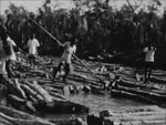
Shotlist: Credits (0.13); Shots of motor cars travelling on busy country road (0.17); By varied countryside, Saxon Cross, and medieval castle to the busy county town. Map showing part of Dumfriesshire with towns of Gretna, Annan, Ruthwell, Caerlaverock, Dumfries and the Solway Firth marked [pseudo-animated route markers] (0.29); Shot of sign reading "Welcome to Scotland" at the border (0.33); Men fishing in shallow river (0.34); Roadsign marking Gretna (0.36); Shots around the town of Gretna including the Marriage Room and driveway to Gretna Hall Hotel (0.49); Shot of giant cooling towers of Chapelcross Nuclear Power Station; cows in a field in f/ground (0.50); Closer shot of towers over wire fence (1.00); Shot of small harbour, towers still in view on horizon (1.02); Road sign for the Royal Burgh of Annan (1.05); Shots of unidentified factories (1.11); Mud flats (1.12); Signpost for Ruthwell Cross (1.18); Shot of church (1.20); Interior of church where cross is on view (1.25); Wall plaque giving a brief history of the cross (1.32); Cross again (1.36); Road and shots of open countryside (1.39); Roadsign to Caerlaverock Castle (1.42); Shots of and around ruins of castle (2.02); Roadsign for Royal Burgh of Dumfries (2.09); Shots around Dumfries and of bridges over River Nith (2.23); Bus park (2.26); Town centre with shots of various plaques and statues, including Robert Burns and Robert the Bruce (2.50); Signpost for Lincluden College giving times of admission and entrance fees (2.52); Shots of the ruined college (2.55); Group of riders on horseback taking part in calendar customs celebrations (3.00); Ceremony at mock-up of city gates (3.09); Same riders going through town centre (3.13); Ceremony on stairs leading to balcony and on platform below (3.32); Pipe band marches along street watched by crowds on both pavements (3.42); Various floats, including prize winners and a series representing "The life of Robert Burns", in procession in main street (4.24); By ancient tower, modern forest, Covenanter's monument, farm, and water mile to the birthplace of Annie Laurie. Map of the area with town of Dumfries, Amisfield, Forest of Ae, Dalgarnock and Maxweltown marked (4.37); Sign for Amisfield Tower (4.40) Shots of the tower and view over surrounding countryside (4.51); Sign for the Forest of Ae (4.54); Shots of tree covered hills (5.12); Road with trees on either side (5.17); Sign for Dalgarnock churchyard (5.18); Shots of gravestones in churchyard and surrounding countryside (5.51); Signpost for "Ellisland Farm, occupied by Robert Burns 1788 - 1791" (5.54) Shot of farm buildings (5.58); Sign giving details of Burns' stay at the farm (6.04); Shots of locations around the farm where Burns wrote some of his most famous works, including "Tam O'Shanter" (6.13); Shot of three-arched bridge (6.16); Signpost for Burnfoot of Cluden and East Cluden Mill (6.19); Shots at the mill of stream and weir (6.29); Road and open countryside (6.32); Sign for Maxweltown House (6.33); Shots of the house and gardens (6.48); Where the bicycle was invented, and explorer born, past a Duke's castle, curious tombstones and the "Admirable" Crichton's birthplace. Map of the area with Maxweltown House, Keir, Penpont, Drumlanrig, Durisdeer and Sanquhar marked (7.09); Roadsign for Keir Mill (7.11); Shots of the mill (7.19); Stone plaque commemorating the building of the first bicycle by the inventor Kirkpatrick McMillan around 1840, and another commemorating the centenary of that event (7.28); Roadsign for Penpont (7.30); Shots around the village of Penpont, including the house in which the explorer Joseph Thomson was born on 14 February 1858 (7.43); Road and open countryside (7.49); Roadsign for Drumlanrig Castle (7.52); Shots of the castle and its gardens (8.06) - Road and countryside (8.10); Shots of Durisdeer parish church and tombstones in the graveyard (8.29); Shot of bridge with two arches (8.33); Sign for Royal Burgh of Sanquhar (8.35); Sign for Eliock House (8.38); Shots of house (8.45); Single arched bridge over stream and shots of open road (8.55); The highest village in Scotland, the Devil's Beeftub, a spa and the Gray Mare's Tail. Map of the area showing Sanquhar, Wanlockhead, Devil's Beeftub, Moffat and the Gray Mare's Tail (9.09); Shots of road in upland area (9.19); Sign for Wanlockhead (9.22); Panning shot of the villager (9.32); Sign giving directions to highest petrol pump in Scotland (9.37); Plaque commemorating the institution of Wanlockhead Library on 1 November 1756 (9.44); More upland scenery (9.49); Sign for Devil's Beeftub (9.51); Shots down into Beeftub, a steep sided hollow on the side of a hill, and shots of stone in memory of the shooting of the Covenanter John Hunter in 1685 (10.12); Shot of countryside with town of Moffat in the distance (10.16); Sign for Burgh of Moffat with the town of Moffat in the distance (10.20); Shots around the town, including the town hall and statue of a ram (10.42); Signs reading "Well Road" and "Old Well Road" (10.46); Shots of Moffat Well (wooden cabin) amongst trees (10.52); Road in upland area (10.57); Sign for the Grey Mare's Tail (11.02); Shots of a high waterfall (11.10); Shots of Birkhall Cottage where Charles Layworth lived between 1872 and 1877. Lapworth recognised the value of grapholites as a clue to the geographical structure of the surrounding hills (11.16) By three ended bridge, forest and reservoir, to where the earth's magnetism and atomic explosions are recorded. Map of the area with the Grey Mare's Tail, St. Ann's Bridge, Twiglees Forest, Black Esk reservoir, and the Eskdalemuir Observatory marked (11.32); Shot of road running through trees (11.37); Sign for Three End Bridge (11.40); Shots of the bridge at Raehills Estate in St Ann's (11.49); Road and open countryside (11.51); Shots in the forest (11.58); Forestry commission sign for Twiglees (12.00); Shot of planted forest on hillside (12.02); Shots of reservoir (12.17); Sign for Black Esk reservoir (12.21); More shots of the reservoir (12.26); Sign Eskdalemuir Observatory (12.30); Shots around the observatory and equipment (12.55); Picturesque woollen town, the birthplaces of Bruce, Telford and Carlyle and back to the Border. Map of the area with Eskdalemuir Observatory, Westerkirk, Langholm, Lochmaben, Lockerbie, Ecclefechan and Gretna marked (13.09); Sign for Westerkirk (13.12); Road and open countryside (13.14); Commemorative stone bench to Thomas Telford (13.21); Sign for Langholm (13.24); Pan of town of Langholm (13.33); Shots of cricket match in progress (13.41); Shots around the town including the woollen mills and a steam locomotive (13.58); Sign for Lockerbie and shots of the town (14.07); Sign for Royal Burgh of Lochmaben (14.11); Statue of Robert the Bruce, shots of countryside and road, and sign for Ecclefechan (14.33); Shots around the town, including birthplace of Thomas Carlyle (14.43); Road and countryside and sign for Bruce's Cave (14.49); Shots of visitors as they are guided to the cave (15.14); Shot of countryside (15.20); Roadsign for Gretna and shots of the town and of sign reading "Haste Ye Back to Scotland" at the Border (15.35); ecs (15.50)